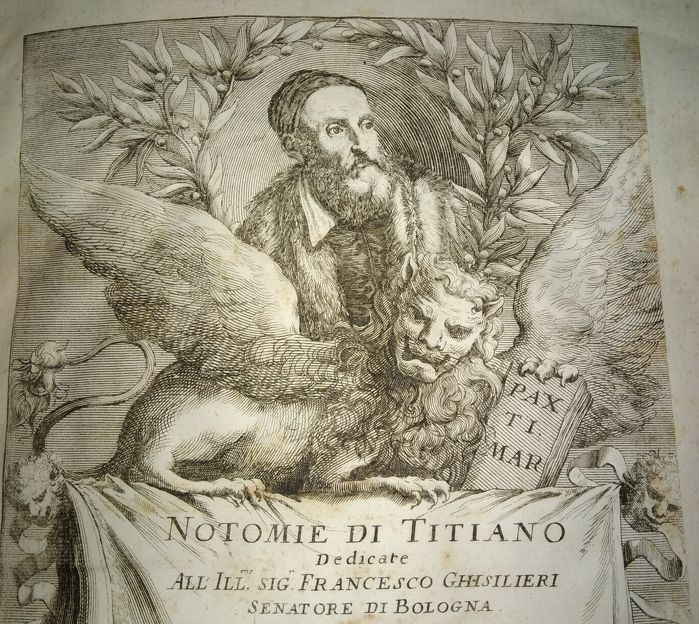
This beautiful book, written by Tommaso Porcacchi, and engraved by GIROLAMO
PORRO is one of the most important geographical books of the Sixteenth Century.
This was the “Golden Age” of exploration and map making, and we are pleased to
offer this fabulous example of the first edition.
First edition of the renowned L’isole – or Island Atlas. In fact, it is far more than this,
with 30 engraved half-page maps and plans representing the most important isles of
the word, including the first continental map of America. The engravings are by the
renowned wood engraver Girolamo Porro. Each map presented in the volume is
followed by a description of the geography, history, economy and interesting facts of
the region, including principal places, physical features, climate, customs and
produce. One of the most important entries is the lengthy account of the arrival of
Christopher Columbus to the Caribbean.
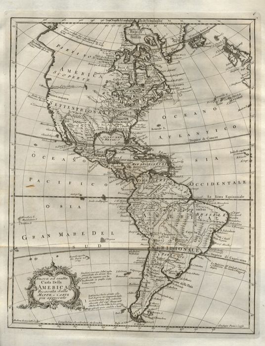
The map of North America is particularly important. It is a smaller version of Forlani’s
map – and the first depicting the landmass as a single continental entity. It is the first
printing of the first Atlas map of North America.
The first 15 illustrations begin with Venice and her surrounds, then pass from east to
west through the Mediterranean, from Corfu, Crete and Cyprus via Rhodes, Sicily and
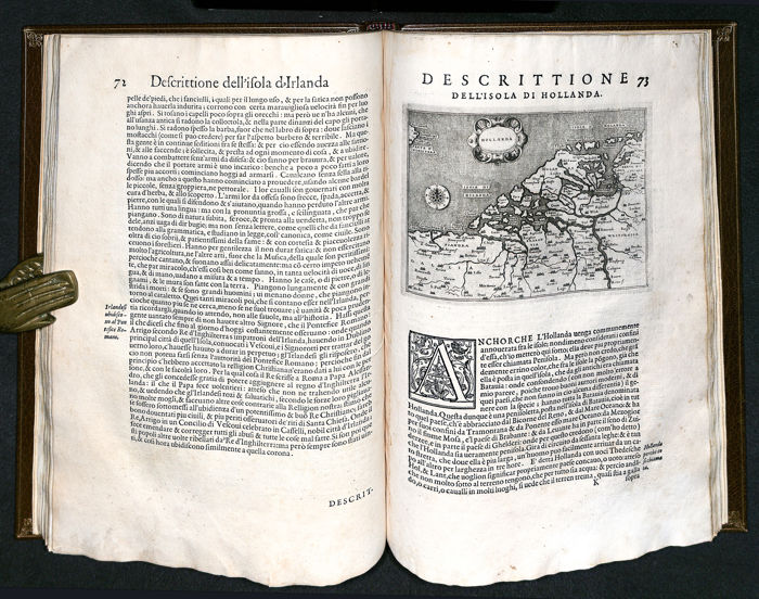
Malta, to Corsica, Elba and the Balearics. The next six are from Northern Europe, the
British Isles, Scotland, Ireland, the Frisian islands, Iceland and Gotland. Across the
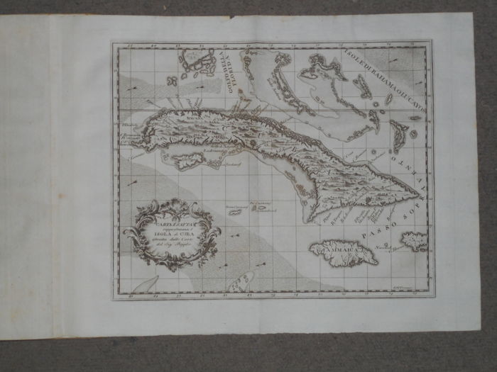
Atlantic are Hispanola, Cuba and St Lawrence, the islands ending with Ceylon and the
Moluccas. The last four illustrations comprise a map of North America, followed by a
detailed plan of Mexico city at the time of the Spanish conquest. The last two are very
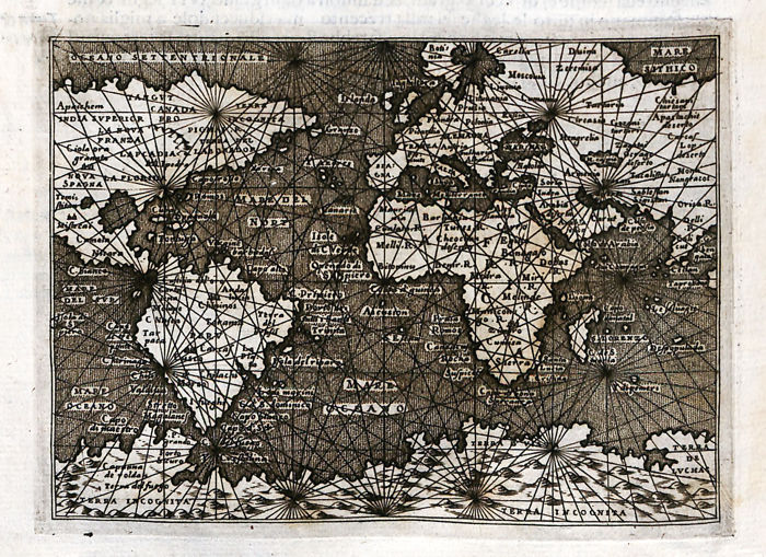
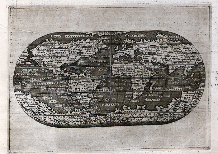
attractive and complete world maps, the second specifically designed for the use of
navigators. Each of the illustrations is accompanied by a few pages of topographical
and geographical description of the subject matter, including principal places,
physical features, climate, customs and produce.
The work was very popular and went through seven editions, the last was published
in 1686 and together with the Isolario of Bordone, the Isole Famose of Giovanni
Francesco Camocio and the Geographia by Livio Sanuto represents the greatest and
fundamental contribution of Italy to map-making, both from a theoretical and a
practical side.
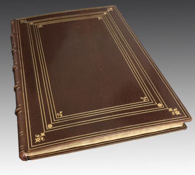
The atlas is beautifully bound in a crushed morocco binding by J. Haines with his gilt
stamp blind-tooled at the lower margin of front inside board, 5 raised bands to the
spine with gilt titles and floral decoration at compartments, boards enriched by seven
gilt border rules with floral and geometrical decoration at the corners.
Naturally, given that this was an island atlas, it was printed in Venice, and this is the
first map shown. Venice had been
At the heart of European printing since the 15th Century. The Serenissima was open
to the ideas of the early Humanists, and in contrast with the Papal States and much of
the rest of Europe, allowed freedom of expression. Despite later condemning Luther,
it remained at the centre of European quality printing.
The Technical bit:
2° (304 x 209mm),, pp. [24], 117, [3] , Copper title with engraved architectural border.
with figures, putti, armillary sphere and globes; printer’s device at verso of last leaf.
Blank leaf b6, often missing, is present in this copy.
COMPLETE
BIBLIOGRAPHY: Adams P-1904; Shirley p.817; Sabin 64148
The full listing of maps:
The first fifteen maps describe the most important isles of the Mediterranean Sea:
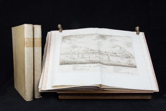
1) Venice
2) Corfù
3) Morea (the current southern Greek peninsula)
4) Candia (Crete)
5) Cyprus
6) Rhodes
7) Full Greek Peninsula
8) Negroponte (The current island of Euboea)
9) Sicily
10) Malta
11) Corsica
12) Sardinia
13) Elba
14) Majorca
15) Minorca
The next six islands are from Northern Europe:
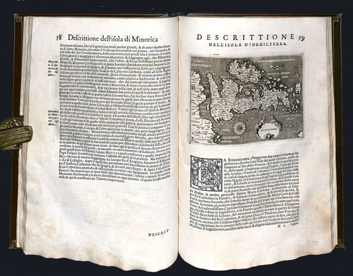
16) England
17) Scotland
18) Ireland
19) Holland
20) Iceland
21) Gotland, in Sweden
Porcacchi then crosses the Ocean and describes:
22) Hispaniola,
23) Cuba
24) St. Lawrence (Alaska)
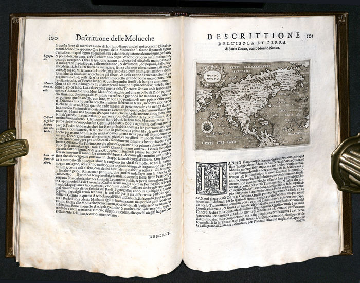
25) Taprobana (Current Sri Lanka)
26) Moluccas
The next two maps include:
27) New World, a detailed map of North America, a smaller version of the
renowned Forlani and Zampieri’s map, the first printed map showing the continent of
North America and the first map to show the Strait of Anina, that separates America
from Asia
28) Temistitan, (current Mexico City). The map shows Tenochtitlan, the capital of
the Aztec Empire, as it appeared to the conquistador Hernan Cortes, when he gained
control of the city in 1521
while the last two are global word maps
30) Global World Map followed by a detailed description of the four elements,
forming the word, water, earth, air and fire, of all the lands and a description on the
measurement system of the world.
31) Navigation map of the world, with the major naval courses of the time, the
major winds and practical instruction on navigation.