You may have heard of Mercator’s projection. This was a rather clever method of showing grid lines, known as “cylindrical projection” which gives the ability to portray a curved earth on a flat surface. It was developed by the Flemish cartographer Gerardus Mercator in 1569. When I was at school, our geography teacher demonstrated this by drawing lines on a large blown up balloon, then letting the air out, cutting it in half and laying the rubber out flat.
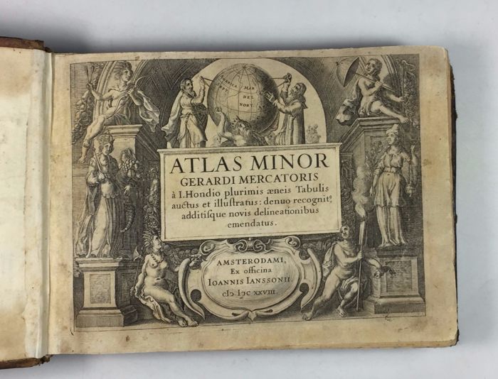
Mercator didn’t just play with projections! He did this as part of his work as a map maker, in order to improve his own maps, and particularly navigation. One of his finest pieces of work was his Atlas Minor, which was printed in 1628. Naturally I have one to show you!
This edition, visible at

is a rather unusual and beautiful oblong edition. It is complete with 142 full page engravings, and is presented in a slightly later binding. A lovely thing to see! Do have a look through the slideshow below.
